.jpg)
2025.07.10
Outline
- Trail Map
- Course Guide & Facilities
- Huts
- Access
- Extra Trail
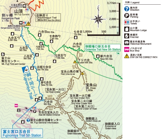
The Fujinomiya Trail departs from the Fujinomiya Trail 5th Station and leads to the summit from the south side of Mt. Fuji on the Shizuoka Prefecture side (Fujinomiya City).
Features of Fujinomiya Trail
- The distance to the summit is short because the trail departs from the highest altitude among the four trails.
- Many climbers choose this trail, following only the Yoshida Trail.
- The trail has steep slopes and many rocky areas.
- The ascending trail and descending trail are the same, and climbers rarely take the wrong path. When it's crowded, take turns to ascend and descend.
Ascending / Descending
.png)
from 5th Sta. to 6th Sta.
- The altitude of the trailhead is 2,380m. Please acclimatize sufficiently to the altitude before departure.
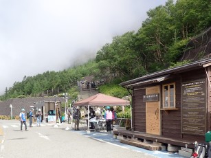
- The entrance to the mountain trail is in front of the information board next to the monument to Alcock, the first British minister to Japan and the first foreigner to climb Mt. Fuji. There is a public toirets right after you go up.
- At the 6th station, it branches off to the Mt. Hoei trail towards the Hoei crater.
- You can also take the Gotemba trail via the Mt. Hoei trail. (commonly known as Prince Route)
| <Facilities at the 5th sta.> Temporary toilets and temporary shops The Fujinomiya Ent 5th Station Rest-House was destroyed in a fire in 2021. Mt. Fuji General Guidance Center (attached to the Fujinomiya Police Station Fujinomiya Exit Temporary Security Outpost) (Opened during the opening period of the mountain trail. Full-time resident during the period of Mt. Fuji navigator/police officer.) Public toilets (open during the period 24h) <Facilities at the 6th sta.> **Toilets in the mountain huts are available 24h a day. |
from 6th Sta. to Summit
- From the 6th station, there is a steep climb up a rocky area.
- The Fujinomiya Trail has the same path going up and down, so it gets very crowded at rocky areas. When climbing, ascending is the priority. Let's compromise and pass.
- A first aid station (hygiene center) will be opened next to ”Ikedakan" hut at the 8th station, with a doctor stationed at all times. However, please check the opening period.
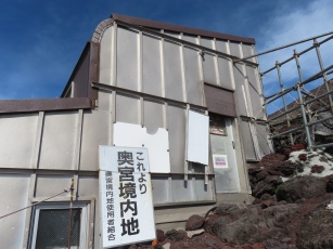
- Passing through the torii gate just below the summit, you will arrive at the summit in front of Mt. Fuji Hongu Sengen Taisha Okumiya.
| <Facilities on the Fujinomiya trail> Hygiene center (first aid station) (Open for a certain period of time during the climbing season. Doctors are on duty 24 hours a day.) **Toilets in the mountain huts are available 24h a day. <Facilities at Summit> Sengen Taisha's Okumiya shrine Post office Public toilets (It is located behind the Summit Fujikan and on the left side of the trail heading towards Kengamine.) |
[!] Please share on narrow mountain trails
The Fujinomiya Trail is a single trail for both ascent and descent. As a rule, climbers have priority, but please share on narrow rocky areas.
[!] Small change is required to use the toilets
Toilets incur a maintenance fee. Please cooperate with the tipping system (contribution). Fees are around 100 to 300 yen.
[!] Follow the toilet precautions
All toilets are environmentally friendly, but the disposal methods and usage rules vary depending on the toilet, so please follow the precautions for each toilet.
Main Facilities
First Aid Station

8th sta. Mt. Fuji Hygiene Center (First Aid Station)
(Next to Ikeda-kan Lodge)
First aid station (Mt. Fuji Hygiene Center) is located next to Ikeda-kan lodge at the eighth station.
- A doctor is always on-site at the aid station and is available 24 hours a day, but please be sure to check the opening period.
-
(About the opening period of Mt. Fuji trails and facilities)
Climbing Information Center

Mt. Fuji General Guidance Center (5th Station)
-
Mt. Fuji General Guidance Center (5th Station)It is located in front of the trailhead.
- Fujinomiya City Tourist Association staff and Fuji climbing navigators (on-site) will provide you with information you need for climbing, such as information on hiking trails and weather information (only during hiking trail opening periods).
- They provide trail guide leaflets and mountain hut booking information.
- During the climbing season, the Fujinomiya Police Station Fujinomiyaguchi Temporary Security Station will be established there.
* Fuji Climbing Navigator: Provides information on mountain trails in foreign languages.
Shops and Rest area
- Climbing equipment is not sold at the fifth station, so be sure to prepare the necessary gear beforehand.
- There are temporary toilets near the bus stop at the fifth station. There are also public toilets a little further up the trail.
- Water and other items are sold at mountain huts along the hiking trails.
| Location |
Facility name |
Web site |
Booking | Remarks |
|
| Web | Phone | ||||
| 6th Sta. | Unkai-so | http://www.unkaiso.com/ | ○ | ○ | |
| 6th Sta. | Houei Lodge | http://houeisansou.com/ index.html |
○ | ○ | |
| New 7th Sta. |
Mt.Fuji Fujinomiya Trail The New 7th Station Goraikousansou | http://www.goraikousansou. com/ |
○ | × | Private room available |
| Original 7th Sta. |
Yamaguchi sanso | https://fujisan-ganso.jp/ | ○ | ○ | |
| 8th Sta. | Ikedakan | https://www.fuji8.com/ | ○ | × | |
| 9th Sta. | Mannennyuki sanso | https://mannnennyuki.wixsite. com/mannennyuki |
○ |
○ | Phone for booking weekday 9:00 - 17:00 |
| 9.5th Sta. | Munatsuki sanso | https://munatsuki.com/en-us/ | ○ | ○ | |
| Summit | Chojo Fujikan | https://fujisanchou.com/guide-for-english/ | ○ | ○ | |
*This information will be updated as soon as it is confirmed. For more information, please visit the web site.
Sorry. The page is currently being created.
Mt.Hoei Trail (Prince Route)

Hoei crater
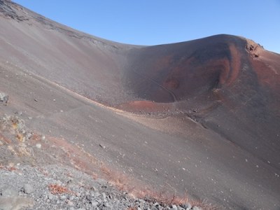
There is a large crater on the southeast side of Mt. Fuji. This is the youngest crater of Mt. Fuji, which erupted during the Edo period. The Mt. Hoei Trail is a course that crosses the crater. You can enjoy the dynamic appearance of Mt. Fuji as a volcano in the crater, which is sparsely populated with Japanese knotweed and several other types of plants.
It can also be used as a climbing route (commonly known as the Prince Route) that starts at the Fujinomiya 5th Station and goes via the Mt. Hoei Trail to the Gotemba Route. Be careful of falling rocks!
The upper part of the crater is prone to collapse, causing rockfall. It is dangerous, so please never walk anywhere other than on the trail.
Use toilets wisely!
There are no restrooms on the Mt. Hoei Trail. During the operating period of the mountain huts, you can use the mountain huts near the 6th station of the Fujinomiya trail and the 7th station of the Gotemba trail.
- Yoshida Trail
- Subashiri Trail
- Gotemba Trail
- Fujnomiya Trail
- Outline
- In-Service / Restriction period
- Other Trails


